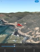


ArcGIS Earth

Description of ArcGIS Earth
ArcGIS Earth is an innovative application that transforms mobile devices into interactive 3D globes for the exploration of geospatial data. This tool is designed to facilitate the visualization, analysis, and sharing of geographic information, making it a valuable resource for professionals in various fields, including urban planning, environmental science, and education. Users can download ArcGIS Earth for the Android platform, allowing them to access a wide range of features that enhance their understanding of spatial data.
The app allows users to view maps, GIS layers, and 3D content seamlessly. It supports various online data services, including ArcGIS Map Service, Image Service, and Feature Service, among others. By connecting securely to organizational resources through ArcGIS Online or ArcGIS Enterprise, users can access authoritative data relevant to their projects. The app also provides functionality for searching for places using world locator services or custom locator services, ensuring that users can find specific locations with ease.
Interactivity is a key component of ArcGIS Earth. Users can draw points, lines, and areas directly on the 3D globe, which facilitates the visualization of geographic features and data sets. The ability to add notes and attach photos to these drawings enhances the context and understanding of the data being explored. Drawings can be shared in KMZ format or published to ArcGIS Portal, promoting collaboration among team members and stakeholders.
Creating and sharing tours is another useful feature of ArcGIS Earth. Users can utilize placemarks and geotagged photos to build guided tours that showcase specific locations or data points. This functionality is particularly beneficial for presentations, allowing users to narrate their findings effectively. In addition to tours, the app supports interactive measurements in both 2D and 3D, enabling users to conduct precise calculations related to distance, area, and elevation.
For those engaged in fieldwork, ArcGIS Earth offers tools for recording GPS tracks. These tracks can be saved in KMZ format or published directly to ArcGIS Portal, providing a method for documenting field activities and observations. The app's integration with other device applications enhances its usability in various workflows, making it a versatile tool for professionals who require real-time data collection and visualization.
Exploratory analysis in 3D is made possible through features such as line of sight and viewshed analysis. These tools allow users to assess visibility and spatial relationships in a three-dimensional context, which is essential for planning and decision-making processes. The ability to visualize data in 3D supports a deeper understanding of the geographical landscape and its features.
ArcGIS Earth also supports a range of offline data formats, including Mobile Scene Packages, KML, and KMZ files. Users can work with these data types without an internet connection, making the app suitable for remote areas where connectivity may be limited. The offline capabilities ensure that users can continue their work regardless of their location, enhancing the app's utility in various environments.
Positioning 3D data on a surface allows for the visualization of information in augmented reality. This feature provides an immersive experience, enabling users to see how data interacts with real-world environments. The application of augmented reality can be particularly beneficial in fields such as architecture and urban planning, where visualizing proposed changes in context can aid in stakeholder engagement and decision-making.
With its comprehensive suite of features, ArcGIS Earth serves as a powerful tool for geospatial analysis and visualization. It accommodates a variety of user needs, from simple data exploration to complex analyses, all within an intuitive and user-friendly interface. By enabling users to engage with geospatial data in a meaningful way, the app fosters collaboration and informed decision-making across different sectors.
The combination of interactive mapping, drawing capabilities, and 3D analysis tools positions ArcGIS Earth as an essential application for anyone working with geographic information. Its ability to connect to organizational data, facilitate field data collection, and support offline use makes it a flexible solution for a wide range of scenarios. Users interested in enhancing their geospatial capabilities can benefit significantly from the features offered by ArcGIS Earth.
ArcGIS Earth is an indispensable resource for professionals seeking to make informed decisions based on spatial data. Its various functionalities cater to the needs of diverse users, making it a valuable addition to the toolkit of anyone involved in geographic information systems.


